 |
|
AboutThe CoastWatch mission is to provide access to near real-time and long-term satellite data to monitor, restore, and manage U.S. coastal and ocean resources, in addition to understanding ecosystems and climate to further enhance society's quality of life. Our primary users include federal, state, and local coastal resource managers, marine scientists, commercial companies, and the general public.
The East Coast Node provides remote sensing data products and customized decision-making applications for regions from Maine to Florida. Anyone may access data free of charge. CoastWatch data is used by local managers and scientists in a variety of ways including ecological forecasting, monitoring algal blooms, tracking sediment plumes, and studying temperature effects on fish populations. We work with regional and local stakeholders to build customized applications for environmental mangagement and decision-making. We are hosted within the National Ocean Service and the NOAA Chesapeake Bay Office Regions currently available at the East Coast Node. Data Access page.
Manager
Operations Coordinator |
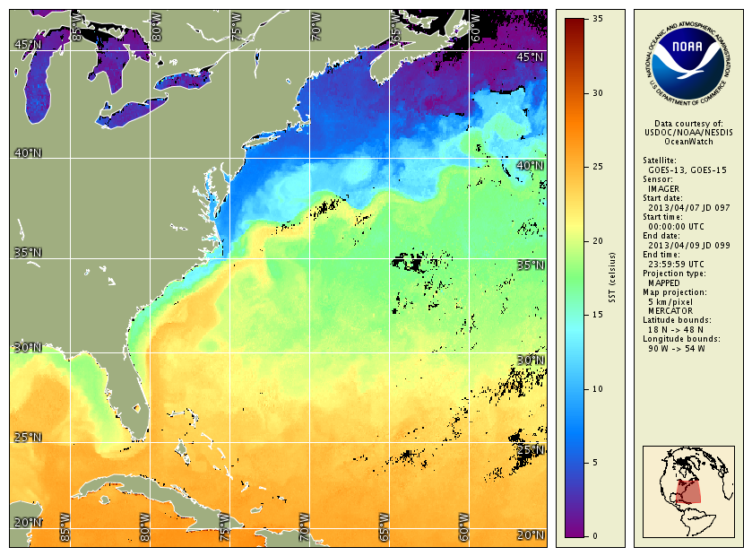 GOES SST, 3-day average, Apr 7-9, 2013
|