 |
|
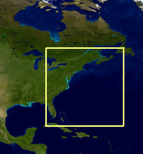
East Coast Satellite Data
Water Temperature
AVHRR
Surface water temperature from NOAA's Advanced Very High Resolution
Radiometer (AVHRR). Overpasses from all operating AVHRR instruments are
averaged into daily, 3-day, 7-day, monthly, seasonal and annual composites
(composite includes day and night overpasses).
Spatial resolution is nominally 1 km.
More information
AVHRR-VIIRS Multisensor
Surface water temperature combined from the Advanced Very High Resolution Radiometer (AVHRR) and the Visible Infrared Imaging Radiometer Suite (VIIRS).
Overpasses from all operating AVHRR and VIIRS instruments are averaged into
daily, 3-day, 7-day, monthly, and seasonal composites (nighttime only).
Spatial resolution is nominally 750 km.
More information
Geo-Polar Blended
Surface water temperature blended from all available U.S. and international
geostationary and polar-orbiting satellites. Greater satellite orbit coverage
and the blending technique assure these data are cloud-free. Only
nighttime satellite overpasses are used. Spatial resolution is 5 km.
More information
PODAAC Multiscale Ultrahigh Resolution (MUR)
Surface water temperature analysis from all available infrared and
microwave satellites. Coverage from all satellites and the analysis
method assure cloud-free coverage on a daily basis. Product is
"foundational" SST, i.e. surface temperature before the diurnal heating
begins. Spatial resolution is 1 km.
More informationChlorophyll-a
MODIS
Chlorophyll-a from the Moderate Resolution Imaging Spectroradiometer (MODIS)
onboard the NASA Aqua satellite, processed using the NOAA OC3 algorithm with
the combined NIR-SWIR atmospheric correction (NOAA OC3 NIR-SWIR).
More informationVIIRS
Chlorophyll-a from the Visible Infrared Imaging Radiometer Suite (VIIRS)
onboard the Suomi-NPP satellite, processed with the NOAA OC3 algorithm
(Wang et al., 2017) and the NIR atmospheric correction of Jiang & Wang
(2014).
More informationSediment Index (Remote-Sensing Reflectance at red wavelengths)
The remote-sensing reflectance (Rrs) in the red wavelengths can be used as a surrogate for sediment concentration in the surface water. As the sediment load in the surface water increases, the reflectance in the red wavelengths will increase. Since the Rrs values are reflectance measurements and not sediment concentration measurements, only relative amounts of sediment in the water may be inferred. Higher Rrs values indicate relatively more suspended sediment compared to lower Rrs values. Patterns of suspended sediment distribution, both spatial and temporal, and sediment gradients may be detected and monitored. MODIS (Rrs at 667 nm)
VIIRS (Rrs at 672 nm)
Diffuse Attenuation Coefficient at 490 nm
MODIS
NASA algorithm: The "KD2" standard algorithm from NASA's Ocean
Biology Processing Group is used. Products are processed operationally by
NOAA CoastWatch: Data Processing Caveats.
NOAA algorithm: The algorithm of Wang, M., et al., 2009, is used, improving values in nearshore waters. More information is available. VIIRS
The Wang et al. (2009) algorithm, developed for MODIS, is used. Atmospheric
correction is with the near infra-red approach of Jiang & Wang (2014), also
known as the BMW atmospheric correction. The Wang (2009) algorithm is
intended to improve values across ocean conditions from turbid to clear.
More information
True Color
East Coast Node filenaming convention Data citation: Please acknowledge "NOAA CoastWatch/OceanWatch" when you use data from our site and cite the particular dataset DOI as appropriate. |
|