 |
|
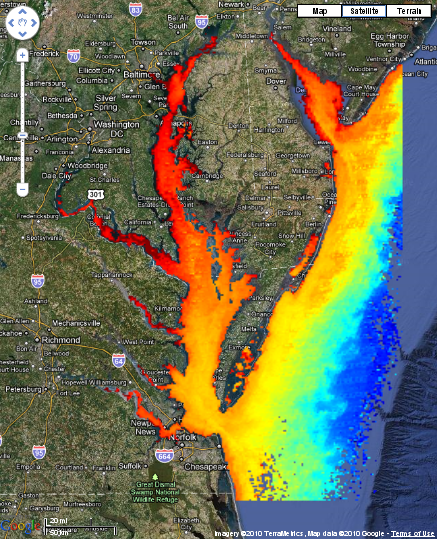
Chlorophyll in Chesapeake Bay
The chlorophyll concentrations seen in these images were calculated using satellite measurements:
Satellites can measure chlorophyll in the water because the satellite can detect subtle differences in the color of the water. Chlorophyll in Chesapeake Bay is calculated using an algorithm tuned specifically for the Chesapeake Bay by comparing in-water measurements from Chesapeake Bay with satellite measurements. The images represent a composite of all scenes imaged by the satellite on a single day. Because the satellite instrument cannot see through clouds, the images may be missing data in areas that were cloudy while the satellite was passing overhead.
|
|